Seven plus hours on the Ice Age National Scenic Trail boiled down to a slice of instants. The hike started on the east side of Delafield and included the Hartland, Merton, and Monches trail segments and their connector routes. I stopped walking on the Waukasha/Washington County Line and met Cory for my return ride at Ox & Cat’s Sports Bar and Grill. Ox & Cat’s make their own pizza.
As for the pictures; there are more than 21 images in the camera, certainly. But several things contribute to the scant number of pictures taken and the subsequent yield. This hike took place December 18 giving me a short daylight window to start with. Since I really wanted to be done hiking before it got completely dark I needed to keep moving. The time available to pause and snap pictures of wonderments was limited by the time and distance involved.
Mellow times walking along Bark River, Hartland
This is also the most suburban hike I’ve done on the Ice Age. From Delafield through Hartland and beyond is settled with homes and businesses taking advantage of the
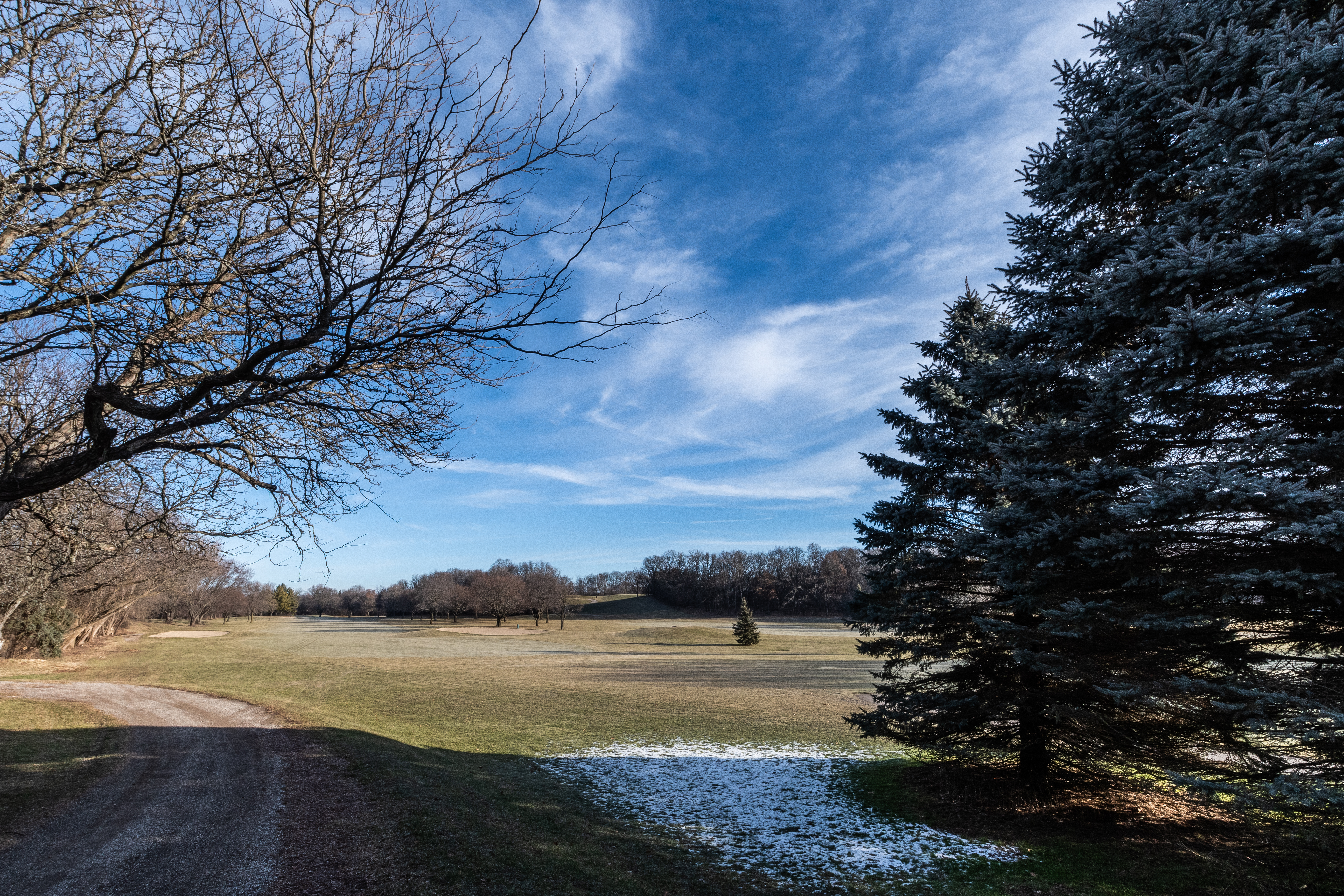
Naga-Waukee Golf Course
remarkable natural settings. At Delafield you start at a golf course. Even the more rural areas reflect people with interests beyond agricultural endeavors. At one point you pop out in front of the Milwaukee Polo Club Grounds. It’s all very cool and interesting but I don’t take a lot of pictures of people’s houses.
Hartland and its trail segment reflect the effort and love of the local Ice Age chapter. It’s a genuinely charming hike to take. Even the connector routes through the suburban neighborhoods are fascinating for a guy who has spent his entire life yearning for the next paycheck. There seem like miles of boardwalks and bridges guiding you over and around streams and wetlands. Following the trail connects you to parks and points of interest. In the Village of Hartland the trail has you duck through an alley where you emerge on the bank of the Bark River which you then follow along.
Hartland and the Bark River approach
There’s serious legwork to do covering the connector on a town road to get to the Merton Segment. The reward was stepping off the street into the woods and walking right up to a herd of deer bedded down in the trees. It was a case of mutual surprise. More legwork follows on The Bugline bike trail where the Ice Age piggybacks the route. It’s also where you walk away from the Bark River and enter the Oconomowoc River Valley.
Human interactions along the trail sometimes get awkward. At a small road crossing a guy stopped his car to talk to me. He was nice but he’d stopped right on the road just over a hill with a blind curve. Of course, a car appeared and had to brake hard as he was telling me he is one of the people maintaining this section of trail. The entire length of the Ice Age Trail is kept up by volunteers like this guy, now parked in the road in front of me. I thanked him for the effort and sincerely, these are well kept trail segments. A second car had to brake for him. “Time for me to go, but your trail is awesome,” I said, taking the moment to start moving.
The world changed at the Monches Segment trailhead. A sense of urgency had begun to creep into the hike as the sun edged lower. I’d fooled around taking pictures back on the Hartland Segment, eaten lunch in a park, and followed a loop trail through a wetland, and earlier I’d walked past a trailhead and into an industrial park where I had to backtrack. Ahead, the Monches Segment is listed at 3.1 miles. On level ground my short, fat legs do three MPH with some ease. But, this is, after all, the Ice Age National Scenic Trail (bitches).
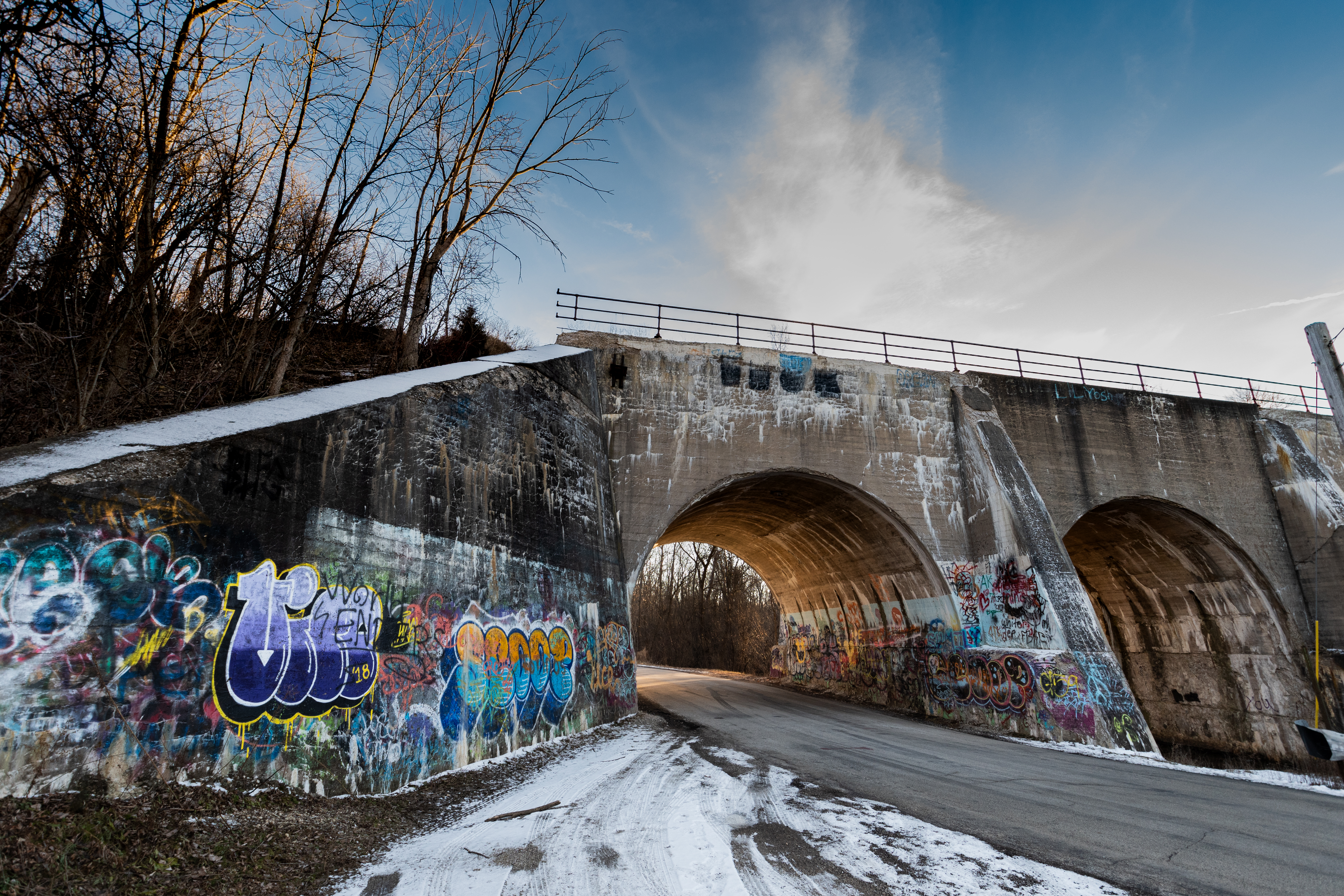
Rail bridge at the Monches Trailhead entering Oconomowoc River Valley
At the trailhead is a double arch, concrete railroad bridge with the river flowing under one arch and the street going under the other. The bridge is heavily tagged with ominous messaging. Shadows seemed to darken and lengthen by the moment so I decided to get on the trail where I bumped into a hiker going the other way. He wanted to chat.
Tim was startled when I answered “Delafield” to his question about where I started. “Yeah, I’m going up to Monches,” I added. “Oh,” he said. “Well, this is a rough trail.” Tim gestured back at where he’d come from and explained it was icy and he’d almost fallen a couple of times. “And it’s steep and gets real narrow and then the river gets real deep,” he continued, and paused, “there’s a little wood bridge.”
Good to know there’s a bridge. “Anyway, Tim, thanks. I better get going, eh?” I said with my goodbye. Tim’s info was mostly correct, including the bridge, but he never mentioned the waterfall.
Thus far in the winter season we’d had some ice-forming cold but I was out walking because the daytime high was peaking at about 45 degrees. Nice walking temperature plus I don’t think feet swell as much hiking on a cold, frozen surface. All day I’d found ice and snow in the deeply shaded and north-facing spots but there wasn’t any snow cover and most of the trail was open.
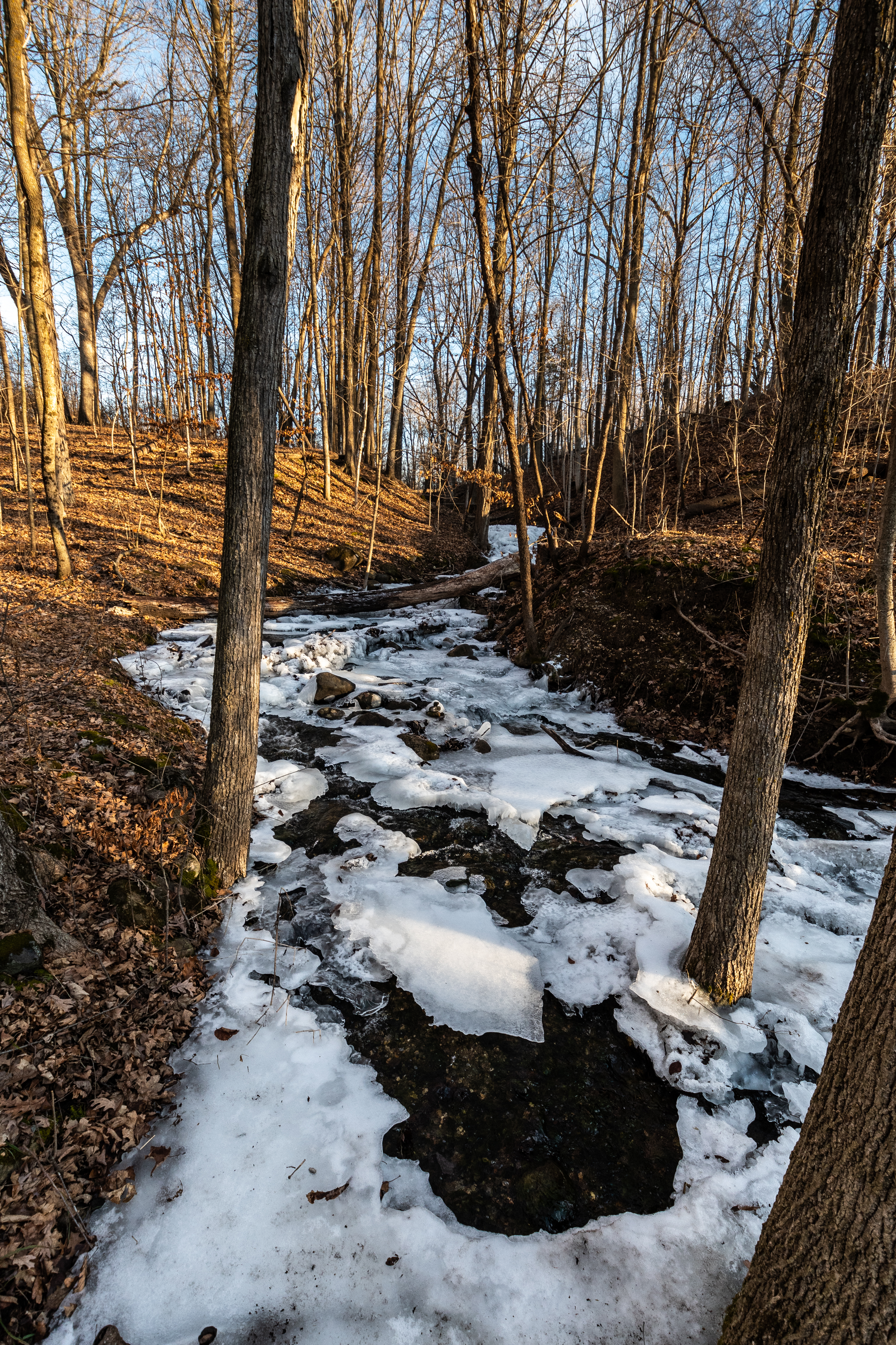
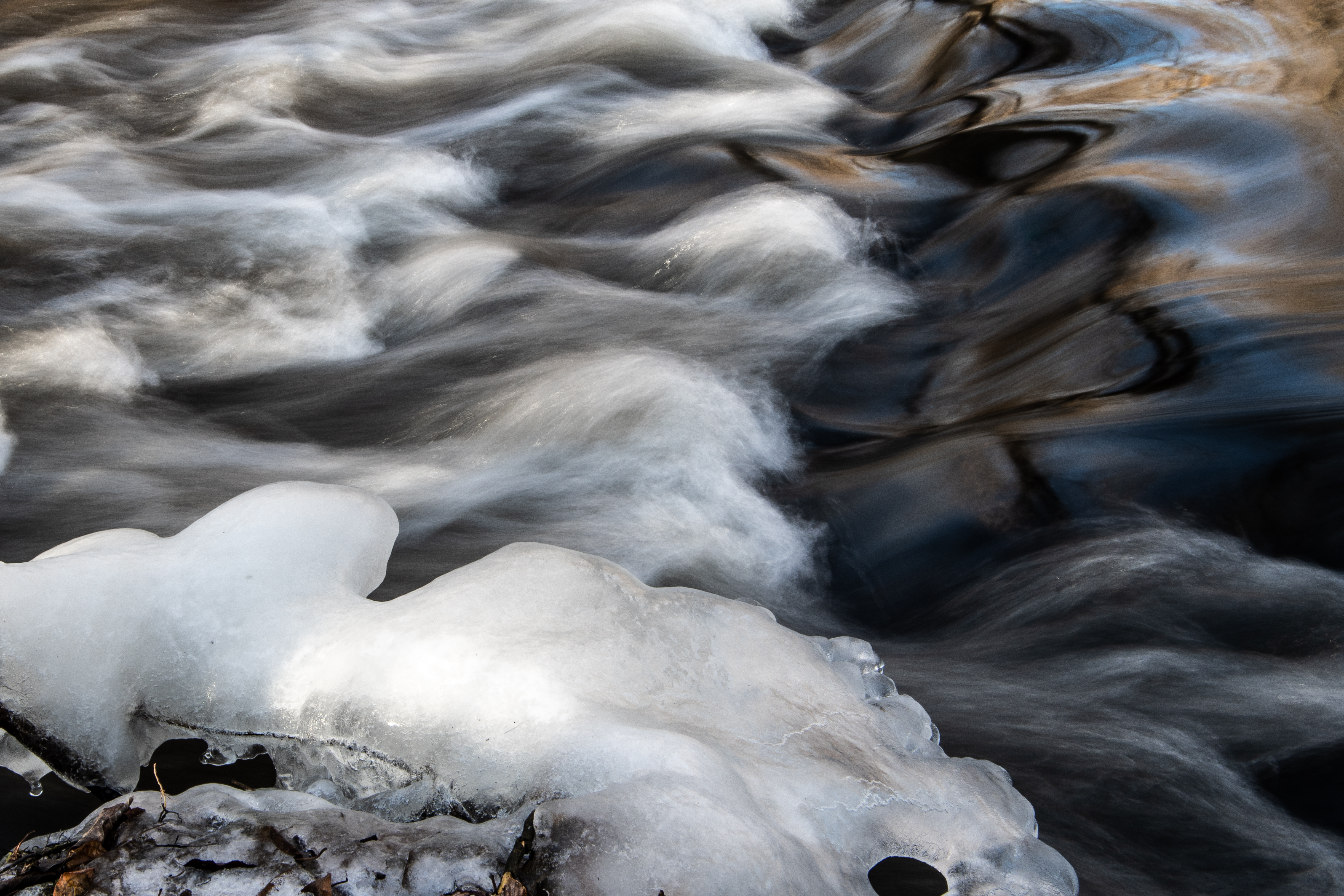
Glacial waterfall
The waterfall came as a jolt. It was glacial, frozen and flowing all at once as it tumbled down the ravine over the boulders and rocks. Water was flowing above and below the ice, swirling around the rocks, gurgling. It took me a minute or two to absorb what I was experiencing. Pictures had to be taken. Pictures take time. The spot already was in deep shade and getting deeper. Time was running out.
Somewhere ahead was steep, narrow, and a wooden bridge. So I snapped a few pictures to document the place, clipped the camera back in place and leaned into the remaining hike. This is a gorgeous three miles. The Oconomowoc River makes it way down the narrow valley producing rapids and eddies flanked by wooded hills and marshes. As you hike north the valley gets narrower and sure enough there is a wooden bridge with its network of boardwalks to get you to the other side. It is the kind of crossing you take one step at a time especially as evening darkness approaches.
There’s some unwritten rule somewhere that the steepest hills always come at the end of the day. After walking for almost seven hours those last couple of hills mean something. I’m not sure what but the challenge is clear.
As you near a trailhead at this time of day the trail runners appear with their dogs. They race by or race past sleek bodies wrapped in the latest running gear. Two damn dogs came out of nowhere and confronted me barking and growling. They broke away and soon their owner came running up the trail. I really wanted to grab a limb and smack the bastard but he had a third dog at his side. Anyway, I thought such thoughts as he went by without a word.
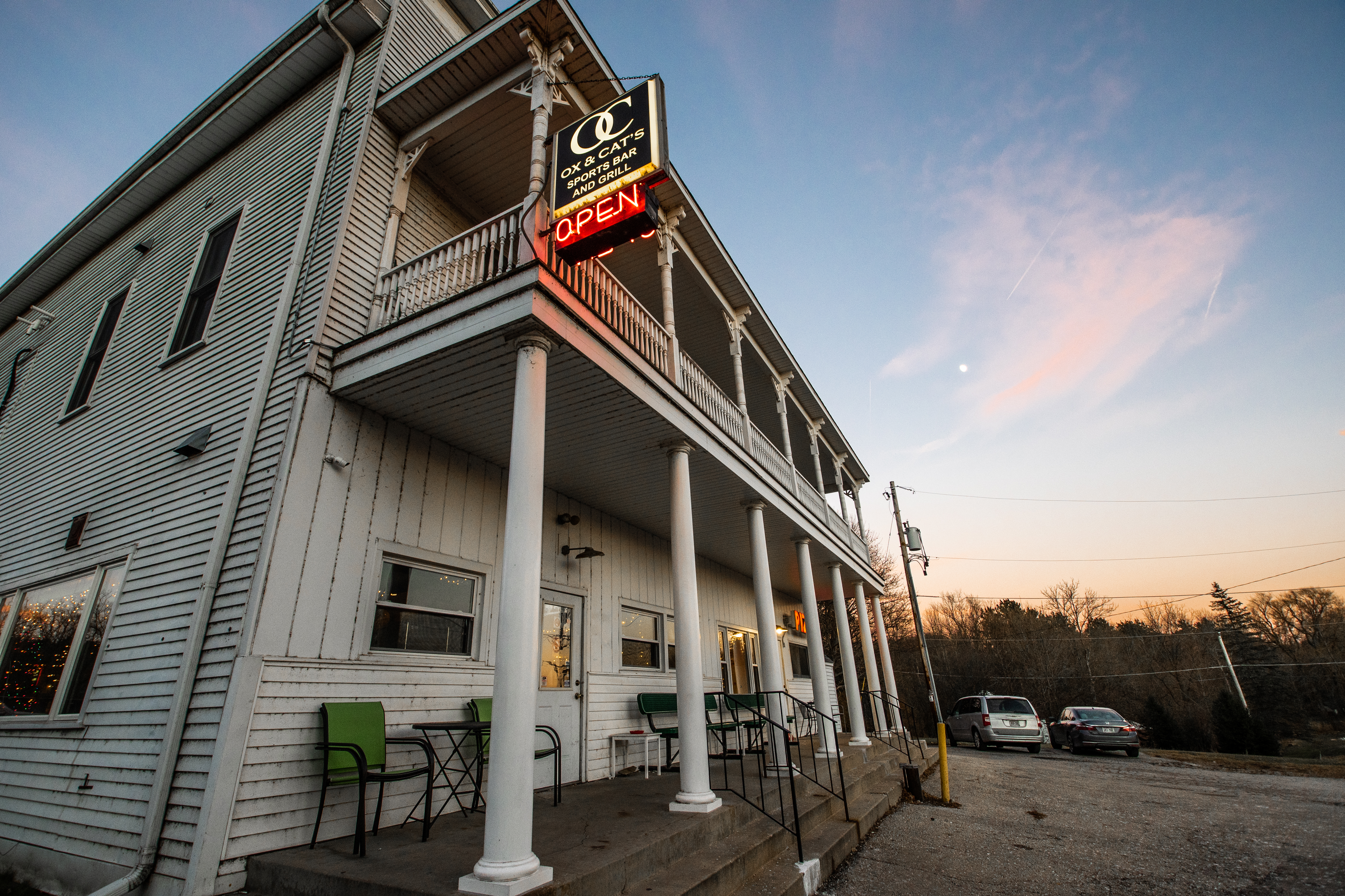
Ox & Cat’s Sports Bar and Grill, Monches
Suddenly the trail turned steeply down and through the openings I could make out Monches with its church and the sign for Ox & Cat’s saloon. There were cars parked at the trailhead and I wondered which one belonged to the guy with three dogs. I minded my business, hiked up to the tavern snapped a couple of quick pictures then went in the front door to find Cory.
Everybody was in there waiting for me; the whole bar full of people looking and grinning. “Dad, you’re kindofa legend,” Cory said. “I’ve been telling them about you.” So I say, “Does being a legend get me a free beer and a burger?” We didn’t stay. Cory hauled me back to my car then we went and had dinner at Panga, a trippy little tavern under the interstate between two lakes.
 Follow